|
JOHN HARRISON'S CLOCK
Please use our A-Z INDEX to navigate this site where page links may lead to other sites
|
|
CLOCKMAKER -
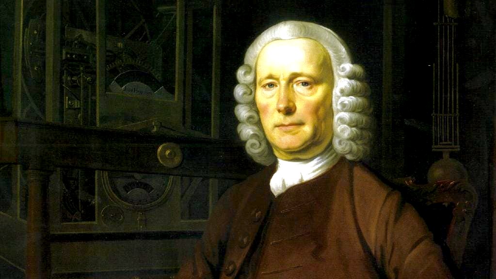
John Harrison was a clockmaker and carpenter by trade. His
clocks were made of wood and were so good, that some examples
are still working today. He is a navigation hero, and where
accurate navigation saves fuel, he is also a climate hero. Boards of so-called experts that are appointed for steerage are self-defeating to some extent where they have vested interests and discriminatory tendencies.
How can anyone say such a thing? One such institution has gone down in history for it's inability to see the wood for the trees is the English 'Board of Longitude.' Even when this collection of appointees held the solution in their hands they refused to recognize it - in this case the hidden agenda was the funding of astronomy for scientific institutions - rather than achieving the objective.
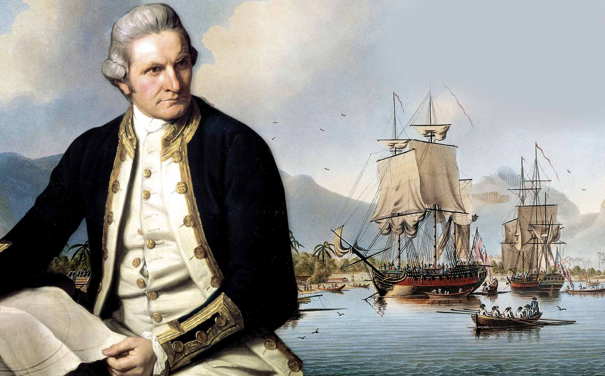
Though, the clients they were supposed to be representing, the sailors in the Royal Navy, accepted the solution with relish. Too wit, Captain James Cook, the famous cartographer, used a copy of John Harrison's H4 to map Australia in the 1770s.
Experts on boards appear not to understand urgency or need, such as we are facing today with climate change. This is true of the nations that comprise the United Nations, where we have had potential solutions for zero carbon homes, cars and ships, but failed to put in place any mechanism to make it happen. The only time committees act with all due haste, is in times of war. Well, we are at war. We are smack in the middle of a climate crisis.
ROYAL NAVY 1707 GROUNDING
In
1707 four ships of the
Royal Navy under the command of Vice Admiral Cloudesley
Shovell ran aground off the Scilly Isles while returning from
the Mediterranean.
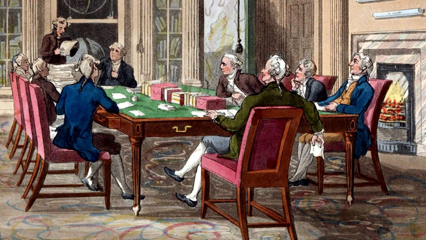
INSTITUTIONALIZATION
- Study of the British Board of Longitude reveals more than just the story of an institution. It shows how economic interests
influenced the political and scientific activities of a state.
The reasons for this were changes within the "scientific landscape" of the United Kingdom and the concomitant struggle for supremacy in influencing the distribution of state support for the science of astronomy and other related scientific projects, the proof of which is that all the surviving papers come from the archives of the Royal Astronomers and their successors, as if John Harrison's solution was perceived as a threat to their dominance of science. John Harrison was thought of as a maverick, who was grudgingly provided financial support, instead of being generously funded to accelerate development.
We should always then look at the appointment of committees and the interests of their members, that should perhaps be recorded in a book declaring such interests such as to avoid potential conflicts.
And so the Board of Longitude was born with a mission to find new ways to fix an east-west position at sea, a notoriously harder problem than finding latitude which can be determined from the position of the Sun.
The Board offered some extravagant prizes up to £20,000 - some $5 million today - for anyone who could locate a position with an accuracy of 30 nautical miles (56 km) accuracy.
The thought of such a large prize gave rise to some crazy ideas. One impractical scheme was to position barges across the Atlantic, from which the crew would let off fireworks so sailors knew their position. If you think about it, satellites in space do something similar.
But the Board’s experts eventually settled on one basic concept which is still in use today - to contrast the time on the ship with the time at a fixed reference point known as Greenwich Mean Time or GMT. So if the time in the home port is 1 pm when the sun in your current location is at its midday zenith, then you know you are 15 degrees of longitude west of the port.
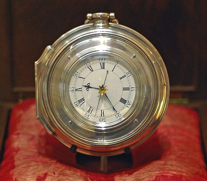
CAPTAIN JAMES COOK RN - For his second voyage Cook took copies of Harrison’s clocks made by watchmaker Larcum Kendall, the original H4 considered too precious to go to sea. Cook praised the accuracy of the clocks based on Harrison’s design. On his third voyage he took a simplified version of the clock, again made by Kendall. This would later be used by Matthew Flinders on his voyages around Australia. Cook later wrote: “I would not be doing justice to Mr Harrison and Mr Kendall if I did not own that we received very great assistance from this useful and valuable timepiece.”
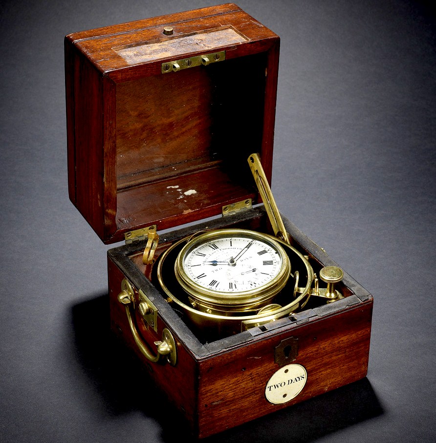
SOLUTIONS
- The chronometer was vital to the ability to create charts and safely
navigate the world. The first chronometers were invented by a carpenter's
son:
John
Harrison.
This gimbaled Marine Chronometer seen above was one on H.M.S. Beagle during its second voyage (1831-1836) with Charles Darwin onboard. It sailed to the coast of South America, across the South Pacific towards the Galapagos Islands, New Zealand and Australia, in order to help establish a chain of reliable navigational co-ordinates around the globe.
BRITISCHE BOARD OF LONGITUDE - Der vom britischen Parlament verabschiedete Longitude Act war nicht der erste staatlich finanzierte Versuch, das Problem der Längengradbestimmung auf See zu lösen. Die Franzosen gingen z.B. bei der Ausbildung und Forschung im Bereich der Navigation zu Beginn des 18. Jahrhunderts sehr viel systematischer vor. Eine in ihrer Ausführung kanalisierte wissenschaftliche Forschung zur Lösung des Längengradproblems wäre in Frankreich demnach eher zu erwarten gewesen. Doch die Geschichte von der Lösung des Längengradproblems ist eine englische bzw. eine britische Geschichte.
Die Navigation auf See war ein unabdingbarer Faktor für die kommerzielle und politische Expansion der europäischen Staaten. Aufgrund der geographischen Gegebenheiten hatte sie jedoch für Großbritannien einen weitaus höheren Stellenwert als für die Staaten Kontinentaleuropas: Der Reichtum und der Wohlstand Englands ganz allgemein hingen in hohem Maße von der Seefahrt ab. Die Studie über das britische Board of Longitude erzählt also nicht nur die Geschichte einer Institution. Sie zeigt zugleich auf, in welcher Form ökonomische Interessen das politische und wissenschaftliche Handeln eines Staates beeinflusst haben.
Die Aufgabe des Board of Longitude bestand ausschließlich in der systematischen Erzeugung praktisch anwendbaren Wissens. Das Board of Longitude war keine universale Gemeinschaft von Wissenschaftlern, sondern ein vorrangig praxisorientierter Zusammenschluss, der die entscheidende Schnittstelle zwischen Akademikern, Anwendern und dem Parlament, das Bindeglied zwischen wissenschaftlicher Theorie und Praxis bilden sollte. Das mit dem Longitude Act von 1714 ins Leben gerufene Board of Longitude unterschied sich damit signifikant von den bisher bestehenden wissenschaftlichen Institutionen. Seine Entwicklung kann dem Ablauf einer stetig zunehmenden Institutionalisierung gleichgesetzt werden. Der Institutionalisierungsprozess war dabei durch konkrete Handlungsziele gekennzeichnet und wurde durch bestimmte Ordnungsprinzipien zusammengehalten. Ziel dieses dynamischen Prozesses war die Lenkung der Wissensproduktion in klar definierte Regeln, Vorgehens- und Verfahrensweisen. Die von den Commissioners for the Discovery of the Longitude at Sea behandelten Fragestellungen und Themenbereiche wurden als relevante Aspekte der wissenschaftlichen Forschung erkannt und entsprechend gefördert. Auf diese Weise war die Produktion des Wissens eng mit dem Staat verbunden. Das vorzeitige Ende der Institutionalisierung begründet sich nicht durch den Wegfall des Handlungsziels. Ursächlich waren Veränderungen innerhalb der „wissenschaftlichen Landschaft“ Großbritanniens und das damit einhergehende Ringen um die Vorrangstellung bei der Einflussnahme auf die Verteilung der staatlichen Unterstützung für die Wissenschaft der Astronomie sowie für andere damit in Verbindung stehende wissenschaftliche Projekte.
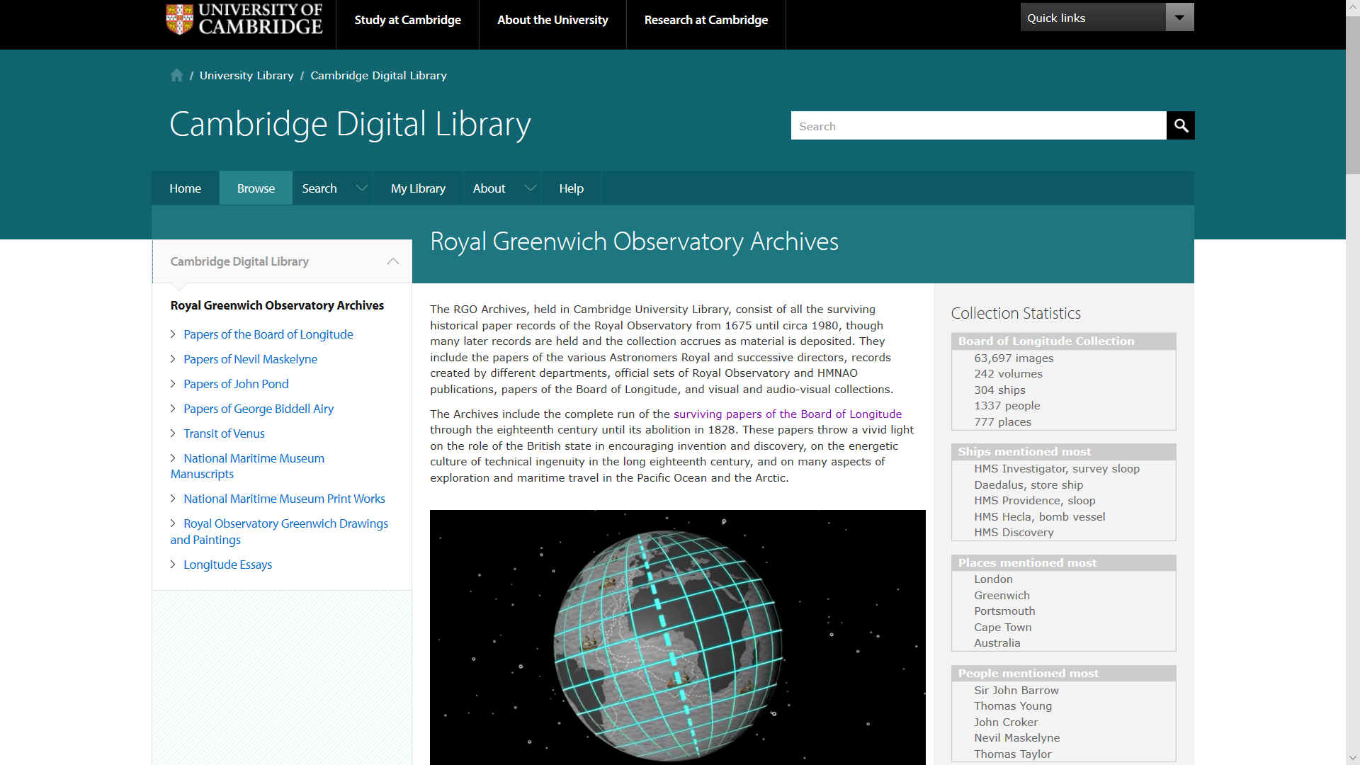
CAMBRIDGE UNIVERSITY ARCHIVES
The sixty-eight volumes of the papers of the Board of Longitude document in rich detail many of this public institution’s remarkably wide-ranging activities over more than a century (1714-1828). The 1714 Longitude Act nominated twenty-two Commissioners, including parliamentarians, administrators, scholars and naval officers. Their official tasks were to judge proposals for determining longitude at sea, fund experiments to try what seemed viable projects, and reward schemes judged successful according to the Act’s stringent criteria.
The current disposition of these archives is mainly due to the nineteenth century astronomer George Airy, a member of the Board when it was abolished in 1828. Its papers were then divided up between the Admiralty and the Royal Society. In 1840 Airy arranged for all the papers to be brought to Greenwich Observatory, and by 1858 he’d ordered them into bound volumes with subject headings that reflect his own classification of the material.
The first volumes of the series therefore include copies of the legislation governing the Board, as well as draft and confirmed copies of the Board’s minutes, and some of its financial accounts. Other archives, such as the papers of Nevil Maskelyne, Astronomer Royal from 1765, document official and unofficial meetings of the Commissioners not mentioned in these minutes. The first recorded meeting of the Commissioners, minuted in RGO 14/5, took place on 30 July 1737, when it was agreed to award £250 to the Humberside clockmaker John Harrison after a trial voyage of his sea clock to Lisbon.
The Commissioners knew that, in principle, a marine clock that could keep time reliably over long voyages, combined with accurate determinations of the ship’s local time, could establish longitude at sea. It is possible that it was Harrison’s project that prompted the Commissioners to start their meetings. The minutes trace the Board’s negotiations with Harrison, large-scale funding for his work, followed by trials of his fourth sea clock in voyages to the West Indies in the 1760s and eventually payments to him of very considerable rewards.
The minutes also detail the Board’s concern in these decades with an alternative astronomical method for longitude at sea, involving computation of the Moon’s motion and observation from ships of the distance between the Moon and known stars. The early volumes record the Board’s receipt in 1755 and 1762 of accurate lunar tables made by the German mathematician Tobias Mayer. From 1767 Maskelyne produced a Nautical Almanac based on these tables that promised to allow mariners to determine their position by observation and calculation. Several volumes of the papers, especially RGO 14/22, deal with the complex business of computing, publishing and correcting the Almanac. Other papers record the interest of the Board in increasingly precise devices for observing the position of the Moon and stars.
From 1774 new laws overhauled and widened the Board’s responsibilities. Records such as the accounts in RGO 14/15-RGO 14/21 illustrate the Board’s reliance on the social networks of particularly important members, especially Maskelyne, Astronomer Royal until 1811, and the public servant and natural philosopher Thomas Young, the Board’s secretary from 1818. Most of the Board’s surviving papers deal with its activities from the 1770s onwards, including schemes for improvement and manufacture of marine chronometers, and sometimes controversial debates about the virtues of rival devices. These projects are detailed in RGO 14/23-28.
The Board also became a clearing-house for many navigational schemes, especially in improved optical instruments and precisely divided scales, magnetic compasses, and a range of survey methods. The archive has rich documentation from hosts of petitioners and makers offering newfangled improvements and seeking reward and sponsorship. Volumes of papers from the later eighteenth and early nineteenth century, RGO 14/29-30, contain documents on instruments for observations at sea, while petitions and correspondence from the same decades, preserved in RGO 14/11-RGO 14/12 and RGO 14/32-RGO 14/41, offer an invaluable record of the activities of a vast number of practitioners, often otherwise little-known, engaged in cartography, mathematics, astronomy, navigation and magnetism in the late Georgian period. Schemes that Airy labeled “impracticable”, collected in RGO 14/39-RGO 14/40, as well as groups of submissions on astronomical theories and on such topics as perpetual motion and circle squaring, held at RGO 14/53-RGO 14/54, offer a fascinating survey of the range of interests of several of these practitioners.
In order to test longitude methods, as well as make geodetic, magnetic and meteorological measurements, the Board hired astronomers for several voyages into the Pacific, including those of Cook in the 1770s, Vancouver in the 1790s and Flinders in 1801. RGO 14/56-RGO 14/61 contain logbooks from Cook’s voyages, RGO 14/62-RGO 14/63 logs kept by the astronomer William Gooch despatched to join Vancouver, and 14/64-RGO 14/68 a range of important logs and correspondence related to later expeditions. Magnetic measures, many pursued as part of campaigns for global magnetic maps and surveys, formed a very significant part of the Board’s work. RGO 14/42-RGO 14/43 hold an especially rich collection of papers on methods for securing and improving compasses and magnetic measures.
The final decade of the Board’s existence, a period of dramatic expansion as well as crisis, is well documented here. In 1818, at a period when the its remit and budget both grew, the Board was also charged with administering rewards for mariners who charted a north-west passage from the Atlantic to the Pacific, and for those navigators who came close to the North Pole.
In 1822, the Board agreed to support the establishment of a new state observatory at the Cape of Good Hope, and the minutes, as well as correspondence in RGO 14/48-RGO 14/49, give some details of this decision and its consequences. In the 1820s, the Board planned collaboration with the Paris Observatory to determine the distance between the two Observatories, and papers in RGO 14/13 detail these plans. The papers also testify to the strenuous efforts exerted by the Board throughout its existence somehow to register, catalogue and control the worldwide distribution of instruments and personnel that formed a vital part of its activities.
Also included in this collection are two items closely related to the papers of the Board - Letters, memoranda and journal containing the history of Mr William Gooch and An account of John Harrison and his chronometer.
EMERGENCY ACTIONS: SIX STEPS TOWARD A COOLER PLANET
Low carbon shipping is just one of Six Suggested Steps toward reversing global warming include building carbon neutral housing, driving clean cars and changing to renewable energy. Humans are creatures of habit. Change is the hardest thing of all.
LINKS & REFERENCES
https://cudl.lib.cam.ac.uk/collections/longitude
Please use our A-Z INDEX to navigate this site
|
|
|
This website is provided on a free basis as a public information service. copyright © Climate Change Trust 2019. Solar Studios, BN271RF, United Kingdom.
|